A wayfinding plan has long been a goal of Zionsville, Indiana. Recommendations for the Town to complete a community-wide wayfinding and signage plan date back to at least 2012, as a recommendation of the Economic-Development Strategic Plan. Other studies since then, including the Comprehensive Plan, Downtown Market Study, Parking Analysis and the Strategic Trails Implementation Plan also recommended such a plan. At roughly 60 square miles and having recently annexed additional land, the Town decided it was time to create a cohesive signage system to help brand the Town and direct visitors to local amenities. The Town hired E. Holdings, Inc. in 2020 to create a full wayfinding signage master plan, utilizing the Town’s brand guidelines.
Core Services Performed:
Signage Design
Wayfinding Planning
GIS Mapping
Condition Assessment & Documentation
Construction and Implementation Plan
Client:
Town of Zionsville, Indiana
Timeline:
December 2020 – January 2022
Wayfinding & Signage Design
The project consists of two phases. Phase 1 included a review of previous planning efforts, a full inventory and assessment of existing signs within the Town, including GIS mapping of the sign locations (by sign type), the creation of a project website, and a community survey.
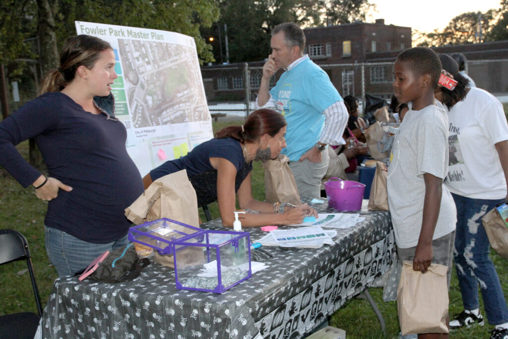
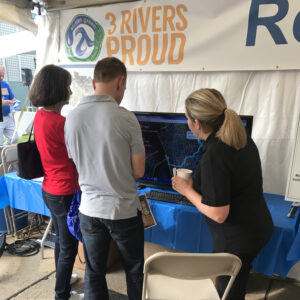
To ensure the new designs successfully captured the wants and needs of the town and to create buy-in for the finished designs, a project brand and website were created. A community survey was conducted to gauge residents’ opinions on signage needs and general design-related questions. E. Holdings designed campaign yard signs, which were placed around the Town, and Facebook posts to advertise the website and survey, which received almost 1,000 responses.
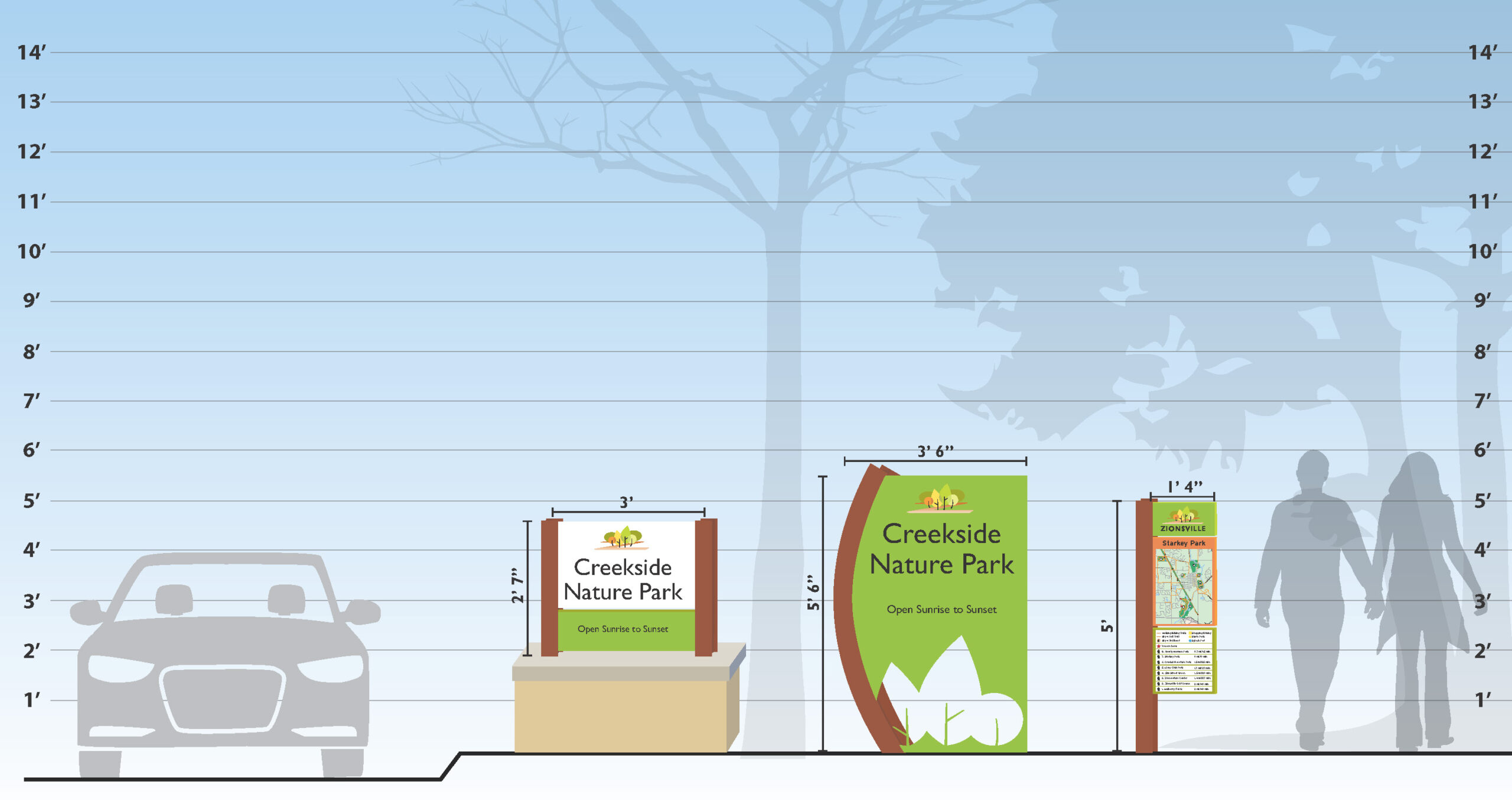
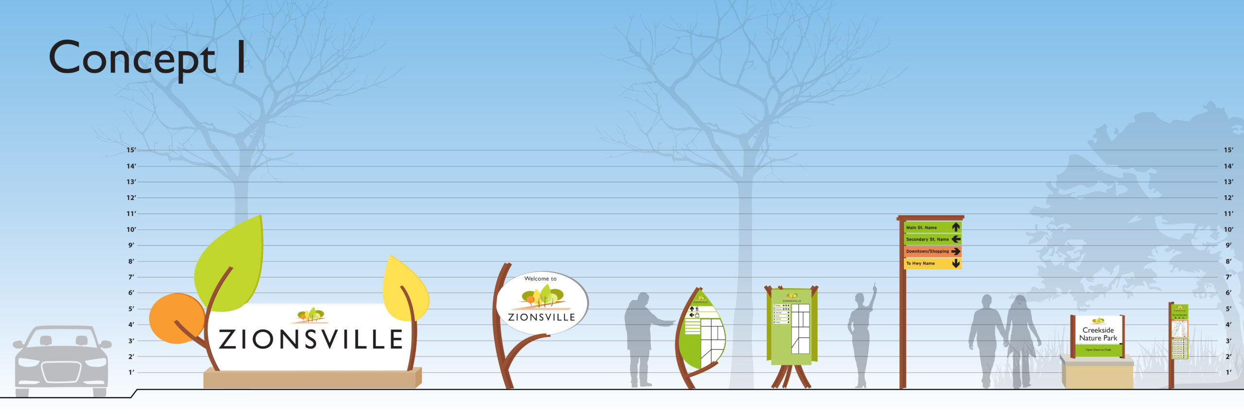
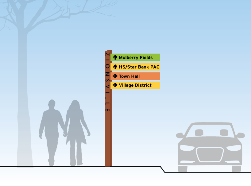
Phase 2 involves the design of the recommended signs, messaging and location plan, and construction bid document package. Our team has developed preliminary design concepts for a full recommended sign family. Upon selection of the preferred concept, we will present them to the public and then finalize the wayfinding master plan.
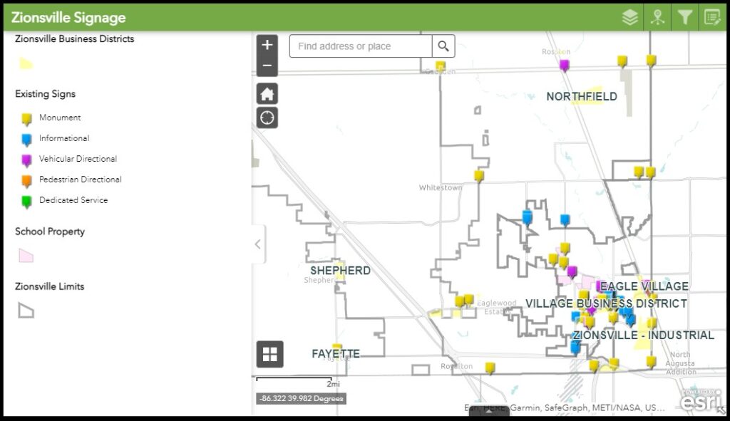
GIS and Mapping
As part of the current signage location and condition assessment a field study was conducted and a GIS database created. The signs were photographed and plotted to aid with identifying gaps and potential locations. This mapping also aided in developing the message schedule. An editable google map was also created and shared with Town officials as part of final QA/QC of sign locations and messaging.
Dave Broniecki Manager of Data Operations and GeoAnalytics
Dave is a NASSCO certified Mechanical Engineer. Specializing in retrieving and analyzing data from various sources to support condition assessment and capital improvement planning activities. Utilizing data to coordinate and track progress on key organizational performance indicators, he assists stakeholders in making decisions related to strategic planning. He has been integral in establishing data management programs essential for planning the future repair and management of large-scale sewer networks. David works with clients to develop training programs and SOPs that address current maintenance needs and future Capital Improvement Planning.
Christine Barton is a registered civil engineer and land surveyor with expert experience in site design, land development, water resources design for civil/site projects including layouts, utility plans, and permitting, and coordination/management of field survey work. She has successfully held positions as project manager, project designer, and office manager to serve the needs of the clients within the residential, commercial, military, industrial, and healthcare industries. Core proficiencies include coordination with local land development planning agencies, county conservation districts, the Pennsylvania Department of Transportation, and the Pennsylvania Department of Environment.
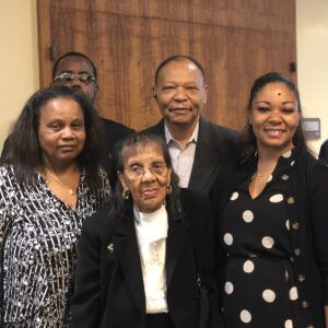
As the President and founder of E. Holdings, Irvin is currently focused on the company’s succession, strategic growth, and development. He has both a professional and personal interest in Pittsburgh’s success. A Pittsburgh native and founder of several development companies, he has an extensive understanding of finance and business, which are vital to the success of this company. He has served in numerous management positions including financial advisor, senior vice president, project manager, general contractor, developer, and construction manager. Active in the local community, he made the decision to dedicate his expertise to rebuilding economically sustainable communities with the approval of their existing residents. In 1996, he and his wife became the first African Americans in Western Pennsylvania to develop and own a commercial office building, Williams Square. He graduated from Pennsylvania State University with an AAS in Mathematics.
Amy’s professional experience crosses a variety of disciplines, ranging from county and multi-municipal comprehensive plans and land use ordinances (zoning and subdivision and land development) to specialized planning studies, such as wayfinding master plans and parks, recreation, trails and greenways plans. She has been employed by E. Holdings for two years and has 20 years of professional experience.
Alexis Meier, MPP Senior Director of Communications, Engagement & Planning
Alexis is the Director of Communications at E. Holdings. There she has worked as the Municipal Coordinator for an in-depth municipal assessment project for the Allegheny County Sanitary Authority (ALCOSAN). She oversees all of E. Holding’s public relations and public outreach efforts. She also brings experience as a Government Affairs Manager for Duane Morris Government Strategies. She worked on community development projects and developing and executing government relations strategies as well as fundraising efforts. She has also spent time navigating our political system in Washington D.C. as the Legislative Staff Assistant for U.S. Senator Rick Santorum. Her understanding of legislation and politics gives her a unique viewpoint when collaborating on civic projects.
Janai Williams Smith, MCP Managing Director and EVP
Janai Smith is the Managing Director and Principal of E. Holdings, Inc. Janai is a versatile, goal-oriented Program Manager with 20+ years of experience supporting the strategic direction of large-scale programs, setting budgets and managing risks while achieving overall company goals and exceeding customer expectations. As a planner and economist, Janai has been involved in a diverse array of projects, among them master plans, urban revitalization plan, visioning studies, brownfield and infill redevelopment projects, strategic planning and infrastructure improvement programs.
Janai’s interest in urban planning, design and infrastructure programs is rooted in a passion for the creation of sustainable communities that deliver equity in planning and implementation by making connections with people and their built environment. Her affinity for complex problem-solving can be seen in the diverse array of projects in which she’s been engaged from revitalization plans for depressed urban neighborhoods to brand new communities and programs. Leading a process-oriented, multidisciplinary team, Janai’s dedication to achieving consensus in her client’s goals and stakeholders’ vision has made a significant contribution to the successful development of numerous projects.