Join our team!
Geographic Information System (GIS) Analyst – Hybrid
- February 3, 2026
Job Details:
- Full Time
- Pittsburgh, PA Office
- Hybrid (In Office 3+ Days/week)
- Monday – Friday
Pay & Benefits:
- Salaried $55,000 – $70,000 (DOE)
- PTO
- 401(k) matching
- Medical/Dental/Vision Insurance
- Flexible Schedule
- Professional Development Assistance
Job Description
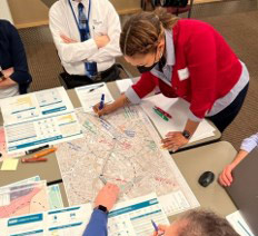
We’re hiring a Geographic Information System (GIS) Analyst to create, manage, and analyze geospatial data in support of engineering analyses, project delivery, and client reporting. This role is ideal for a technically skilled, detail oriented professional who enjoys transforming complex spatial information into clear, actionable products. You’ll work closely with technical and business teams to build GIS databases, produce compelling maps and reports, develop analytical tools, and support spatial data needs for federal, state, and local clients.
Why You’ll Love Working Here
You’ll contribute to meaningful, real-world projects that support infrastructure planning, community development, and client decision making. You’ll collaborate with multidisciplinary teams, sharpen technical skills, and grow your career in an environment that values innovation, accuracy, and continuous improvement. We offer competitive compensation, strong benefits, flexible scheduling, and a collaborative culture where your work has visible impact.
What You’ll Do
- Create, develop, and maintain GIS databases, spatial data layers, and linkages to external systems
- Produce professional maps, cartographic products, and visualizations for internal and client deliverables
- Perform spatial data entry, quality control, and ongoing database maintenance
- Support engineering and business teams with technical GIS support and spatial analysis
- Generate reports and deliverables that communicate spatial insights effectively
- Write and maintain executable code/functions and analytical tools (e.g., Python/ArcPy scripts)
- Develop and document coding workflows to automate GIS processes
- Support business development efforts by preparing technical documentation and contributing to proposals
- Maintain organized project files and metadata in accordance with standards
- Typical daily tasks include data creation and editing, map production, coding for analysis or tool development, and coordinating GIS deliverables with stakeholders.
Required Qualifications
Education & Experience
- Bachelor’s Degree in GIS, Geography, Planning, Engineering, Computer Science, or closely related field or equivalent combination of training, education, and experience
- 4–6 years’ experience working with GIS or closely related spatial data discipline
Technical Skills
- Experience with ESRI technologies (ArcGIS Pro, ArcGIS Online, EsriDeveloper)
- Strong working knowledge of SQL, Python/ArcPy, or other scripting languages
- Experience with Visual Basic, personal geodatabases, SDE databases, and SharePoint
- Preferred (not required): Experience with AutoCAD and JavaScript
Professional Skills
- Strong understanding of relational database organization, design, and functionality
- Proficiency in processing and analyzing raster and vector geospatial data
- Demonstrated knowledge of cartographic design and production principles
- Excellent interpersonal and organizational skills with strong attention to detail
- Effective verbal and written communication skills
Licenses
- Valid driver’s license, personal automobile, and current automobile insurance required due to travel duties associated with the role
Required Qualifications
Primary Focus: (80%) – Technical GIS Services & Project Deliverables
- Creating, developing, and maintaining GIS databases
- GIS product development and spatial data management
- Cartography and production of mapping products
- Technical support to engineering, communications, and business management teams
Secondary Focus (20%) – Analysis, Tool Development & Support
- Development of analytical tools (coding) within GIS environments
- Support of business development initiatives